The days between Christmas and New Year’s Eve were getting slightly boring. We needed a short getaway and didn’t plan one for the end of year holidays… We started to wonder why… Time was limited (2 days) so if we still wanted to go it had to be close by. The both of us never really were hikers, but we want to give it a try. Since we haven’t done a lot of hiking, we have a lot of places left to discover. For this time we picked Les Hautes Fagnes. It turned out to be a winner. We got a beautiful and foggy day on the grassy plateau around Signal the Botrange and a lovely day in the woods on our second day.
So we had 2-days time, in those 2 days we did the following:
- a 10 km hike around Signal the Botrange (the highest point in Belgium)
- a visit of Monschau were we spend the night
- a second 10km hike in the Trôs Marets valley
What are Les Hautes Fagnes?
Les Hautes Fagnes (their French names) or De Hoge Venen (as we call them in dutch) are a part of the “Les Hautes Fagnes – Eifel nature park”. They are a plateau region in the province of Liège, in the east of Belgium, lying next to the German border. The plateau is situated between the Ardennes and the Eifel highlands. Les Hautes Fagnes are record holders in Belgium. With their 4.501 hectares it’s the largest nature reserve in Belgium. And it’s highest point, the Signal de Botrange, is the highest point in Belgium reaching 694 metres above sea level.
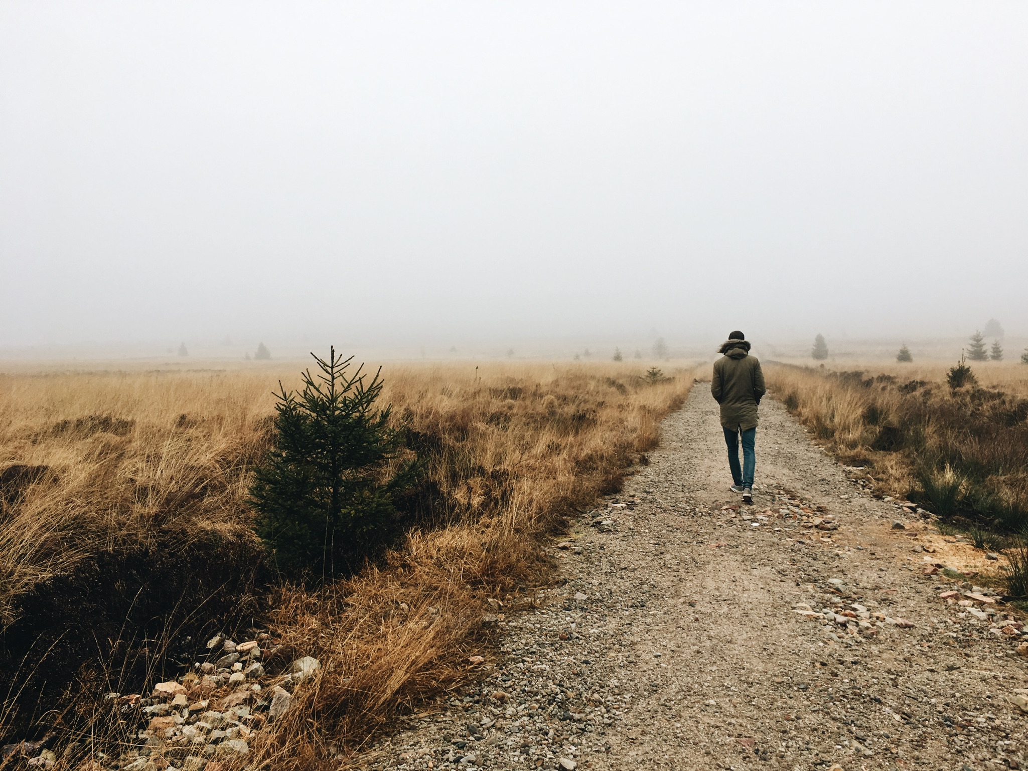
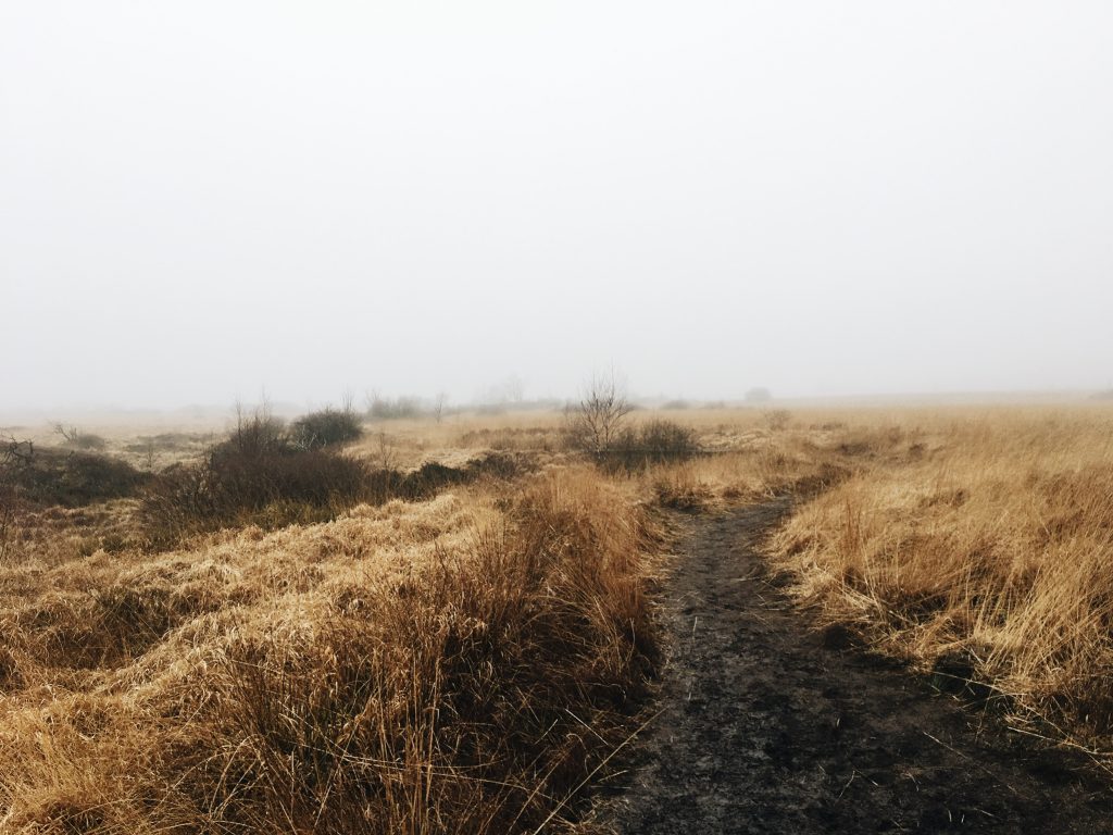
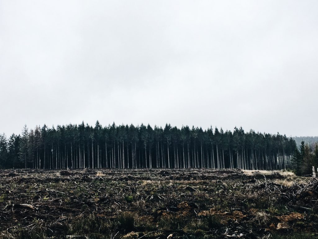
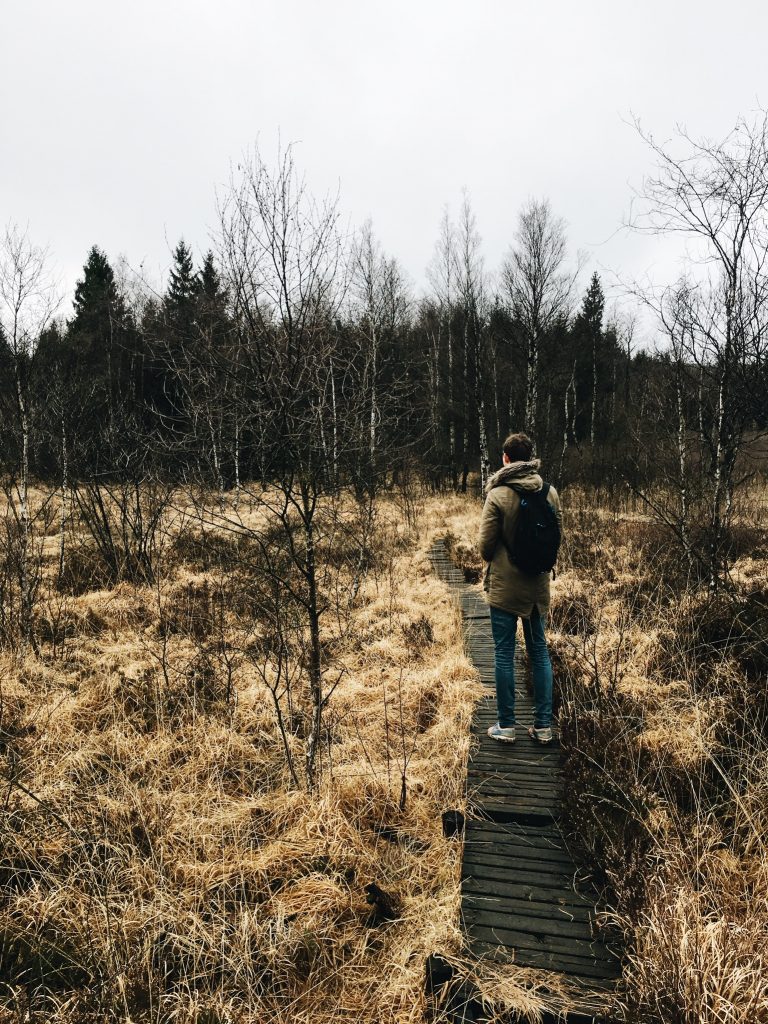
Hike 1 : Signal the Botrange (11km)
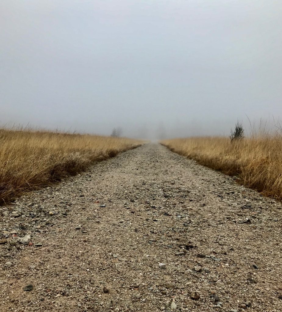
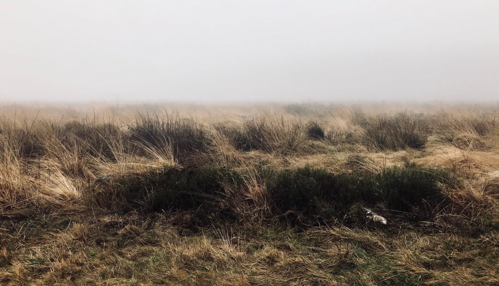
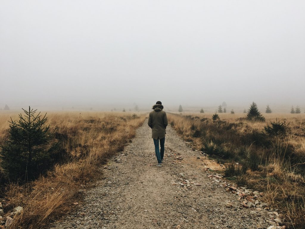
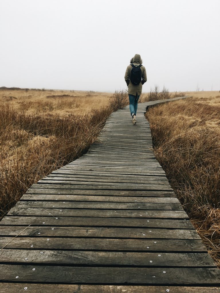
It was an utterly beautiful and foggy winter day. So taking some nice shots wasn’t too difficult. The 11km walk took us a little over 2:30 hours at a rather slow pace. The walk started over a grind road but became a little muddier after a while. Luckily the wettest parts were bridget with wooden trails.
You Start the walk at the Signal the Botrange (the highest point of Belgium) where you can park your car. Where you head straight into the “Fagne wallone” a grassy plateau. You see pines on one side grass-land, almost looking African, on the other. The walk goes on over rolling hills and you will discover something new around every corner. This landscape was unlike anything we had seen in Belgium. A special place, definitely worth two and a half hours of your time.

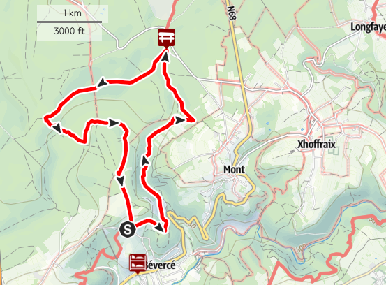
Tip: download the map of the walk here and download the GPX Tracker app to view the map (iOS).
Details of the hike:
- Start: Signal de Botrange
- Length: 11km
- Height difference: 182m
Monschau, our base to discover Les Hautes Fagnes
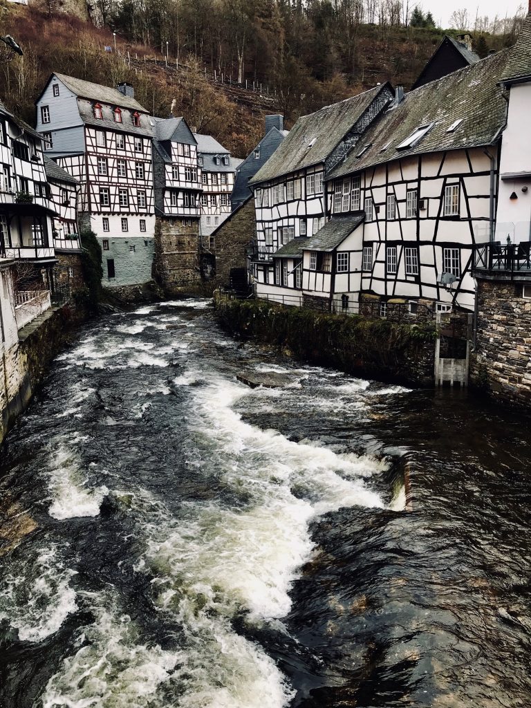
We spend the night in Monschau, a small village just across the German border. What you get is a medieval townscape with idyllic half-timbered houses, narrow streets and cobblestones.
Monschau has quite a lot of eateries and bars as it is a rather touristy place. But for some reason that did not bother us here. Well, we only stayed for one night and that is probably enough for a place like this. So go, enjoy it, order Schnitzel with a German beer for dinner, get a good night of sleep and leave again the following day for more hiking.
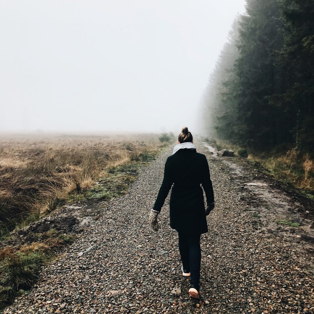
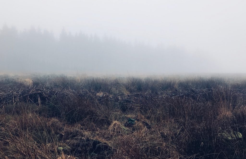
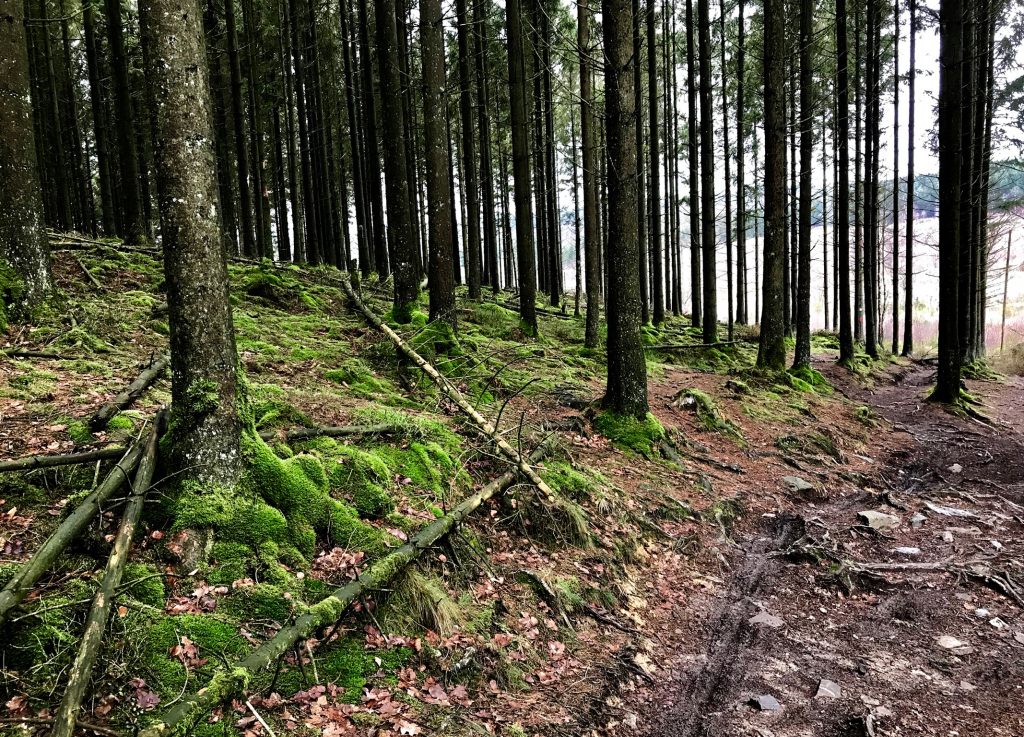
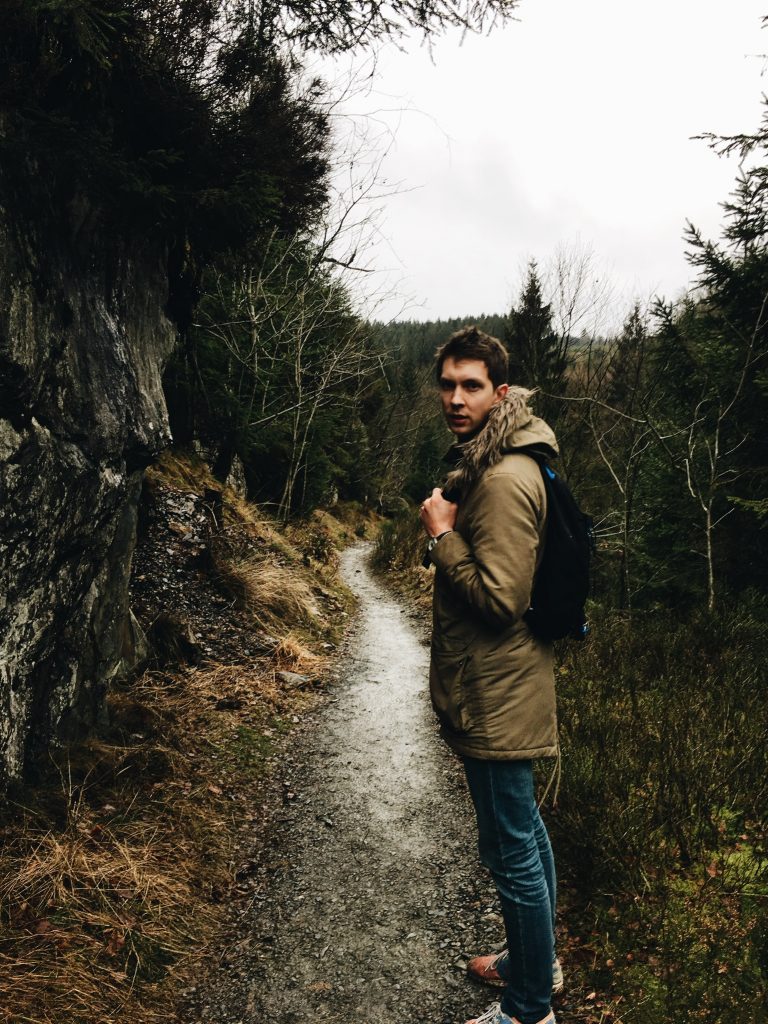
Hike 2 : Trôs Marets Valley (10km)
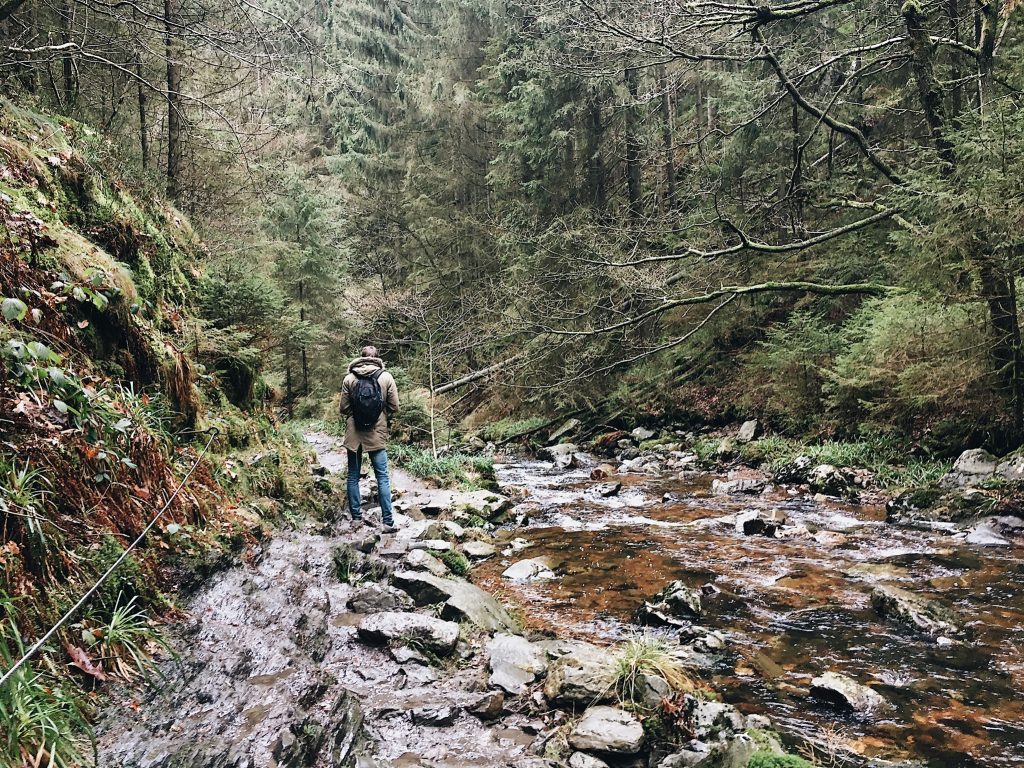
Second day, second hike. After a short morning walk through Monschau we head for a 40 min drive in the direction of Malmedy. Our walk starts at Hotel Ferme Libert. We start with a pretty steep climb seeing some deer on the side and walk through some fields to start with. Soon we start walking through pine forest. After about 3km we take a turn to the right and follow the river over a wet trail for about one kilometer. After following the river it’s back through the forest again, the path is easy and wide for a while but the last quarter of the walk is a little more challenging. You start a descent to the river bedding, climb over some rocks and than start to climb back up again gaining altitude quite fast (Belgian standards of course 😉 ).
Tip: download the map of the walk here and download the GPX Tracker app to view the map (iOS).
Details of the hike:
- Start: hotel Ferme Libert.
- Length: 11km
- Height difference: 182m

No Comments